-
Reflections on Creating a Map
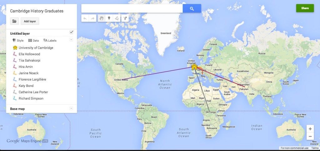
by Hira Amin To showcase the sheer diversity in research being undertaken at the University of Cambridge by history MPhil and PhD students, I decided to create a map pinning each student to their research area. This brief article will outline the thought process and actions behind the final product.
-
Medieval Mappaemundi (World Maps)
by Julia Bourke Medieval world maps, or mappaemundi, are something worth sharing even today because of what they tell us about how medieval people viewed their world. While we have our own, modern techniques of map making, the mappaemundi provide us with a different vision of the world and its geography.
-
What’s in a map?
By Zoe Farrell | @zoeffarrell At first glance, a map is a simple entity. It is a tool through which towns and cities can be organised so that people can gain knowledge of places, roads, waterways and significant buildings. However, maps are often in fact complex objects of state building, propaganda and identity formation. J.…
-
9. 1891 Map from Populations Past

By Dr Alice Reid (@amrcampop) This map, from PopulationsPast.org, shows the sex ratio among working-age adults in 1891, calculated from census data. Areas in red have more men than women and areas in blue have more women than men. Geographical differences in the sex ratio reflect nineteenth century migration patterns and employment opportunities which pulled…
-
Two Maps of the Mediterranean

Two maps of the Mediterranean, one included in the medieval cosmological treatise Book of Curiosities of the Sciences and Marvels for the Eyes (Kitāb Gharā’ib al-funūn wa-mulaḥ al-ʿuyūn) and the other frequently reproduced in modern scholarship, first appear very distinct, but perhaps share a similarity: they reflect a mariner’s view of the Mediterranean.

